


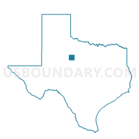
Voting District 0007, Jones County, Texas
About
Outline

Summary
| Unique Area Identifier | 675178 |
| Name | Voting District 0007 |
| County | Jones County |
| State | Texas |
| Area (square miles) | 46.76 |
| Land Area (square miles) | 43.89 |
| Water Area (square miles) | 2.87 |
| % of Land Area | 93.85 |
| % of Water Area | 6.15 |
| Latitude of the Internal Point | 32.58879340 |
| Longtitude of the Internal Point | -99.64502210 |
Maps


Graphs
Select a template below for downloading or customizing gragh for Voting District 0007, Jones County, Texas


Neighbors
Neighoring Voting District (by Name) Neighboring Voting District on the Map
- Voting District 0001, Callahan County, TX
- Voting District 0006, Jones County, TX
- Voting District 0204, Taylor County, TX
- Voting District 0404, Shackelford County, TX
- Voting District 0405, Shackelford County, TX
Top 10 Neighboring County Subdivision (by Population) Neighboring County Subdivision on the Map
- Abilene CCD, Taylor County, TX (118,774)
- Hawley-Noodle CCD, Jones County, TX (10,028)
- Clyde CCD, Callahan County, TX (9,287)
- Albany CCD, Shackelford County, TX (2,962)
- Lueders CCD, Jones County, TX (827)
Top 10 Neighboring Place (by Population) Neighboring Place on the Map
Top 10 Neighboring Unified School District (by Population) Neighboring Unified School District on the Map
- Abilene Independent School District, TX (102,266)
- Clyde Consolidated Independent School District, TX (12,567)
- Hawley Independent School District, TX (3,220)
- Albany Independent School District, TX (2,589)
- Lueders-Avoca Independent School District, TX (787)
Top 10 Neighboring State Legislative District Lower Chamber (by Population) Neighboring State Legislative District Lower Chamber on the Map
- State House District 60, TX (148,990)
- State House District 71, TX (146,722)
- State House District 53, TX (145,845)
- State House District 85, TX (143,267)
Top 10 Neighboring State Legislative District Upper Chamber (by Population) Neighboring State Legislative District Upper Chamber on the Map
- State Senate District 30, TX (823,594)
- State Senate District 24, TX (778,148)
- State Senate District 28, TX (704,340)
Top 10 Neighboring 111th Congressional District (by Population) Neighboring 111th Congressional District on the Map
Top 10 Neighboring Census Tract (by Population) Neighboring Census Tract on the Map
- Census Tract 205, Jones County, TX (5,221)
- Census Tract 301.02, Callahan County, TX (4,543)
- Census Tract 201.02, Jones County, TX (4,394)
- Census Tract 9503, Shackelford County, TX (3,378)
- Census Tract 133, Taylor County, TX (2,878)
- Census Tract 201.01, Jones County, TX (2,031)